


SRP dam and lake management
Dams have long played an important role in Arizona’s history, helping transform our state from a dry desert into a prosperous community.
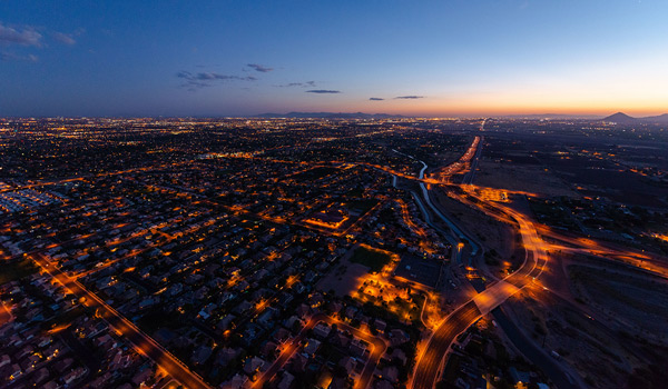
Delivering the desert’s most precious resource
For more than a hundred years, dams have provided clean energy, flood control and a steady water supply to the Valley.
Today, we rely on dams to generate hydropower, help us prevent floods and ensure a reliable supply of water so we can face climate change and drought with certainty.
Discover the role of dams in Arizona’s past, present and future, and see how SRP operates, maintains and manages the dams and reservoirs for the U.S. Reclamation Bureau.
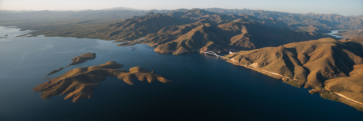
Holding back the waters
Dams are constructed to contain water during high precipitation periods, forming a reservoir or lake. This creates a variety of benefits for our state.
Flood control
Dams help control the flow of water so we don’t have floods.
Water supply
Dams allow us to store water for future needs, helping to ensure a reliable supply.
Recreation
The reservoirs created by dams offer a place to enjoy the outdoors.
Hydropower
Dams use the power of flowing water to create electricity.
Harnessing the power of water
SRP manages several dams that generate hydroelectric power, also called hydropower.
How Hydropower works
Dams store river water in a reservoir. As water is released, it flows through a turbine, spinning the turbine and activating a generator to produce electricity.
Supplying renewable energy to the grid
SRP dams can generate a combined 230 megawatts of power when demand is high. That’s enough to power 172,000 homes.
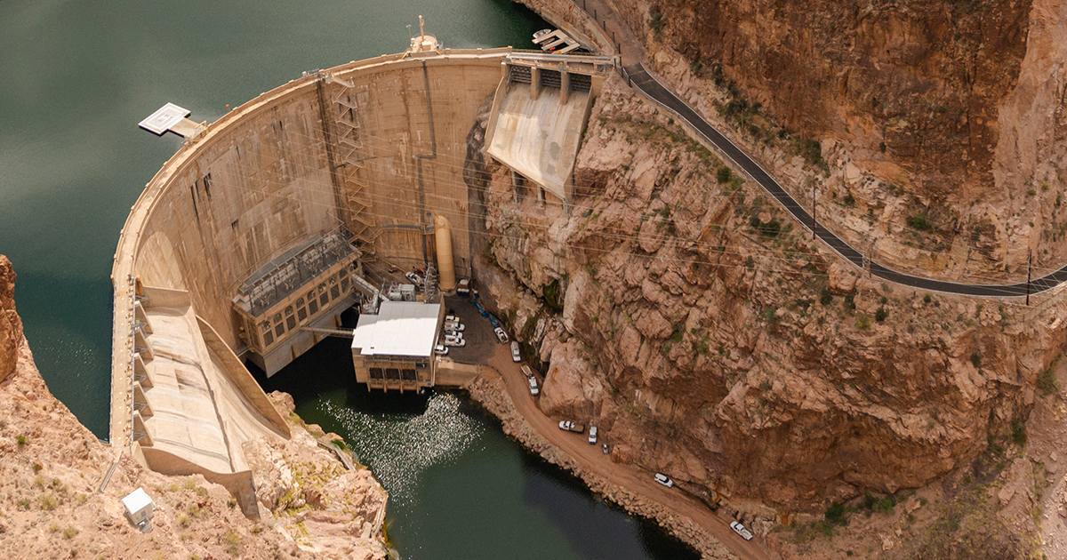
Explore SRP-managed dams
We’re proud to manage five dams on the Salt River (including a diversion dam), two on the Verde River and one on East Clear Creek.
Explore the dams that supply water and power and provide opportunities to enjoy the great outdoors.
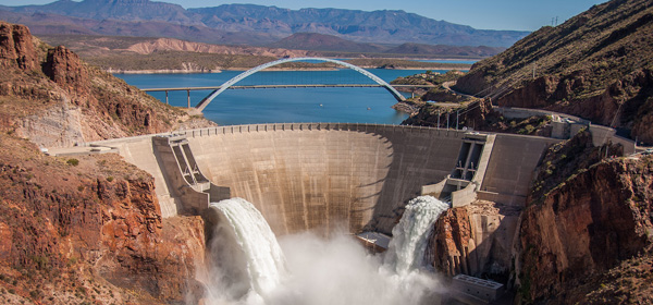
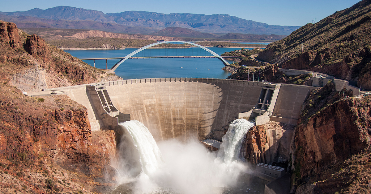
Theodore Roosevelt Dam
Purpose: Hydropower, water supply | Theodore Roosevelt Dam turned the Arizona desert into land that could be farmed. It also formed Roosevelt Lake, a destination for boating, fishing and enjoying the outdoors.
Learn More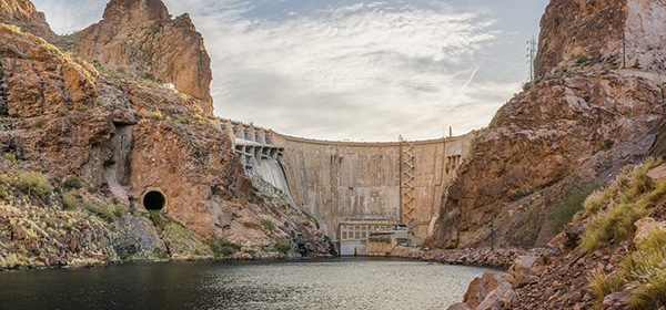
Horse Mesa Dam
Purpose: Hydropower, water supply | Horse Mesa Dam was constructed between 1924 and 1927. It forms Apache Lake, an uncrowded escape for fishing, boating and more.
Learn More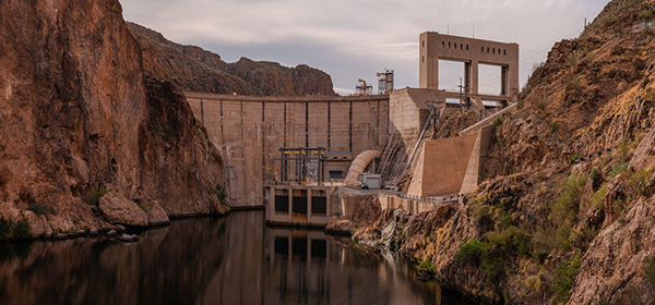
Mormon Flat Dam
Purpose: Hydropower, water supply | Formed by Mormon Flat Dam, Canyon Lake is the smallest of the Salt River Project lakes. It offers fishing and a beach area.
Learn More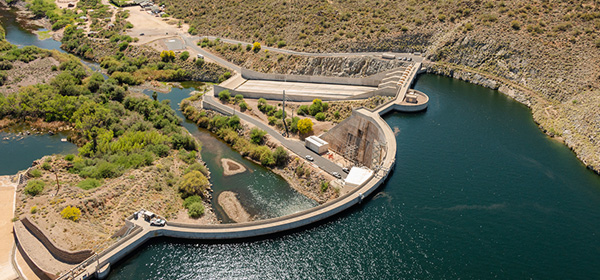
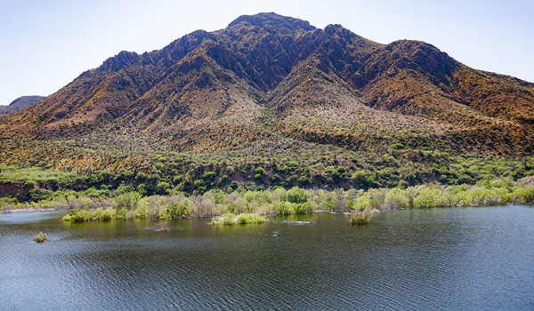
Stewart Mountain Dam
Purpose: Hydropower, water supply | Stewart Mountain Dam is named after the old Stewart Ranch. It forms Saguaro Lake, which is set in the Sonoran desert and surrounded by canyon walls.
Learn More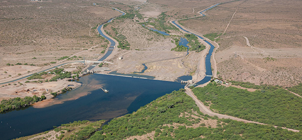
Granite Reef Diversion Dam
Purpose: Water diversion into canals | The Granite Reef Diversion Dam diverts water from the river into canals for irrigation and drinking water in the Valley.
Learn More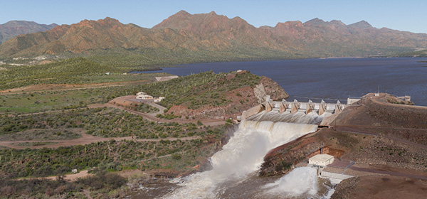
Horseshoe Dam
Purpose: Water supply | Horseshoe Dam is named for the horseshoe-shaped bend in the Verde River at the dam site. It forms Horseshoe Lake, a quiet destination for outdoor enthusiasts.
Learn More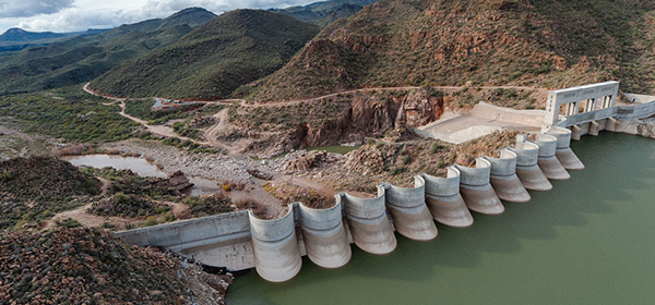
Bartlett Dam
Purpose: Water supply | Bartlett was the first dam built on the Verde River. It forms Bartlett Lake, set in the heart of the Tonto National Forest.
Learn More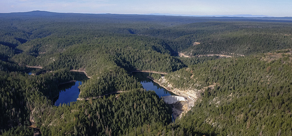
C.C. Cragin Dam
Purpose: Water supply | The C.C. Cragin Dam creates the beautiful C.C. Cragin Reservoir, a camping, boating and fishing haven on the Mogollon Rim.
Learn MoreManaging the desert’s water since 1903
It all started in 1902, when President Theodore Roosevelt signed the National Reclamation Act. The law provided federal loans for construction of reclamation projects in the West.
In 1903, a group of Arizona ranchers and farmers pledged their own land as collateral for a loan to build a massive water storage and delivery system.
The group later formed the Salt River Valley Water Users’ Association, one of the founding organizations of SRP. Their idea for a dam would later become the nation’s third-largest public power utility and one of Arizona’s largest water suppliers.
See more SRP history
Protecting and conserving wildlife
To offset the impacts that dam and reservoir operations can have on threatened, endangered and at-risk species in nearby areas, SRP developed two habitat conservation plans (HCPs).
These HCPs outline our long-term commitment to wildlife conservation efforts targeting the following species:
- Southwestern willow flycatcher
- Western yellow-billed cuckoo
- Bald eagle
- Ridgway’s rail
- Northern Mexican garter snake
- Narrow-headed garter snake
- Lowland leopard frog
- 10 native fish species
Protecting habitats
To provide protected habitats for several of these species, SRP has acquired and manages select properties along ecologically sensitive Arizona waterways.
In all, SRP manages nine properties — approximately 3,000 acres of riparian and upland habitats that provide protection for threatened and endangered species.
Approximately 3,000 acres of riparian and upland habitats that provide protection for threatened and endangered species.
In addition to managing these properties, SRP created a new breeding habitat for Southwestern willow flycatchers and Western yellow-billed cuckoos. To do so, 20 acres of cottonwood and willow trees were planted near Roosevelt Lake. Additionally, a 5-acre plot of marsh bird habitat was created on the lower Gila River to support the endangered Ridgway’s rail.
Creating a water supply for the future
In addition to the water stored in the seven reservoirs we manage, SRP has developed two underground storage facilities that take advantage of the natural process for recharging aquifers![]() .
.
Underground water storage, also called water banking, involves storing water in an aquifer. An aquifer is a porous layer of underground rock that can hold and release water.
During wet years, extra water is stored underground. That way, during dry years, the Valley is ready with enough water.
Underground water banking: how water is captured and stored
Extra water is fed from SRP’s canals into a large, porous basin where it can seep down into the aquifer below.
When the water is needed, one of our nearby wells is used to pump it back up to the surface.
At SRP, we regularly adjust how much water we pump from our wells based on how full our lakes are.
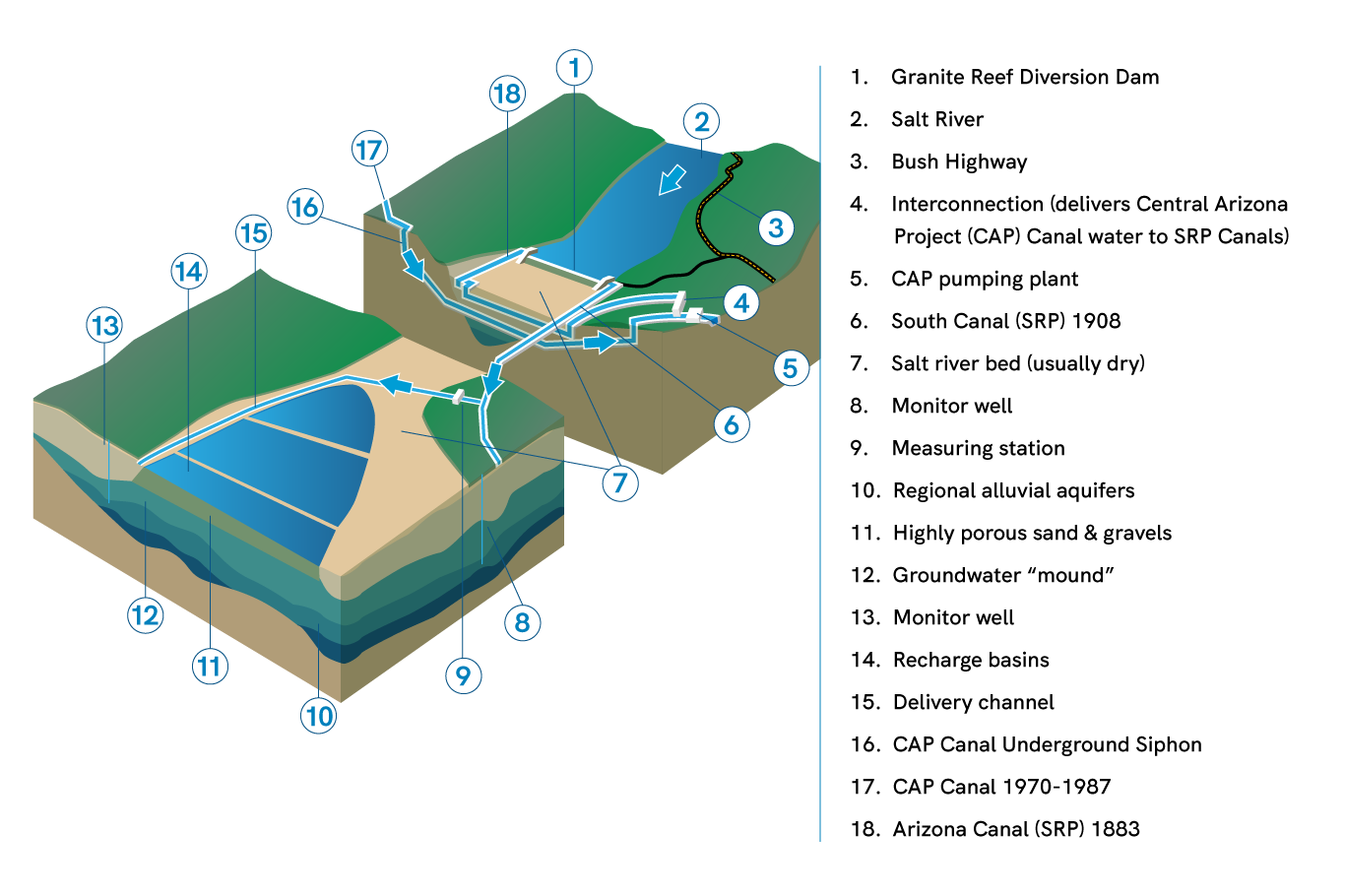
Underground storage projects
The Granite Reef Underground Storage Project (GRUSP) and the New River-Agua Fria River Underground Storage Project (NAUSP) were developed through partnerships with nine cities for storing water from a variety of sources. GRUSP and NAUSP allow Arizona to make the most of its Colorado River entitlement and help the state reach its safe yield goal.
Learn more about GRUSP and NAUSP here.
Safe yield is a balance between the amount of groundwater pumped from an aquifer and the amount recharged into it.
RELATED TOPICS
Hydropower 101: Sustainable and clean energy | SRPconnect Blog
Hydropower is the term used for electricity that is produced from the clean energy of moving water. Learn more about its role in the Valley.
Where your water comes from in the Phoenix metro area | SRP
Central Arizona’s water supply comes from three main sources — the Colorado River, the Salt and Verde river systems and groundwater. Learn more here.
Flowing into the future of water
The tech behind the scenes.